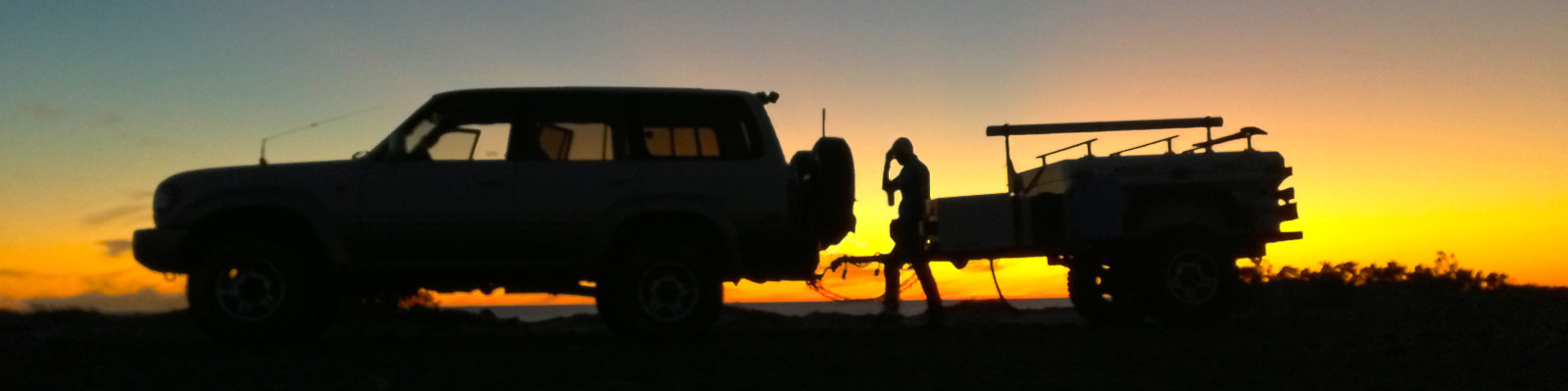
Day 33 – (8/18/15) Lake Disappointment to Well 18, 62 miles.
The sunrise over Lake Disappointment was amazing. We wandered out on the lake bed and took in the beauty around us.

It is at Lake disappointment that our Delorme InReach Explorer decided to stop working. It would not charge and appeared to be completely dead. This is not the best place for our Satellite communicator to die. Hopefully we won’t need it!
Luckily, our family and friends had a very detailed emergency plan in their hands. Hopefully they will not overreact and contact the authorities.
Below is our emergency plan:
____________________________________________________________________________
Most of the below is for reference if we do go missing. The most important takeaway is to alert the authorities if we don’t check in by the dues dates below. We will tell you guys when we start and finish a remote track. This won’t be for a few days.
You should be able to track us and communicate with us with our inReach satellite device. Obviously, only if that fails will you have to alert the authorities…
We’re writing this to make sure all of you have an idea of where we’ll be in case you don’t hear from us for an amount of time. You can relay the below information to the authorities…
Since Rena and Tony are “in country”, we’ll make them be the primary point of contact in an emergency. But, Adam will be a better resource for what the capabilities of us and our equipment are for the authorities. Sri will be good at dealing with international issues if they arise. Erin is along for the ride.
Rough Plan
Sydney > the Simpson Desert > Alice Springs > Ayers Rock > back to Alice Springs > Tanami Track to Halls Creek (or Billiluna) > the Canning Stock Route to Wiluna > somehow to Perth and fly/sail from Perth
If we deviate from this rough plan, we’ll get a message out to as many of you as we can. Exact dates/times are impossible to predict in remote travel. We’ll at least contact you at the beginning/end of the locations outlined above.
Communication Technology
UHF CB
This is Australia’s 476MHz CB radio network. Due to the nature of these high frequencies, the signal pretty much travels line-of-sight. If we’re in a valley, the range may only be a few hundred meters, hilltop to hilltop range may be 10’s of miles, and flat land could be a few miles. (Adam should have a sense for this since we have used 150MHz Ham radios.)
This will mostly be used to keep in contact with other travelers on the same road/track. Certain tracks/areas/roads have designated channels for travelers to use. We will be using those when we know them.
If we go missing, we’ll monitor the track channels and the emergency channels (5 and 35). If we have enough electrical power (we should), we will continuously monitor those channels. If our power is waning, we’ll monitor at the top of the hour (times that end in :00, like 5:00).
Our equipment is a GME TX3100, 5 Watt mobile transceiver.
Ham Radio
This will be of dubious value. It seems most Australians just use the UHF CB. Regardless, we’ll be running APRS (145.175MHz) when we have power. (APRS is the Automatic Position Reporting System protocol that sends out GPS coordinates. Adam knows a bit about this.) And, we’ll be monitoring their “calling” frequency which is 146.500.
On aprs.fi, search for KJ6UGI-9.
We have 2 meter (~150MHz) and 70cm (~440MHz) capabilities with our Kenwood TM-D710A (50W) mobile unit and Kenwood TH-D72A (5W) handheld radios.
These have similar range as outlined above for the UHF CB. We’ll monitor continuously or at the top of the hour as conditions dictate.
DeLorme InReach Explorer
This is our two-way satellite communicator and tracker (text only, no voice). This will be our “go to” device to contact the outside world.
When moving, we’ll leave it on so we can be tracked. If we stop for a day or two, we may not leave it on continuously. If we go for a hike or a tour in another vehicle, we’ll take it. The point is, since it’s handheld, don’t assume it’ll indicate where the truck is. It should indicate where we are…
We’ll send out a text/email with this device when we get to major beginning or ending points. If possible, respond back to these messages so we know at least someone got the message.
We may also simply get bored and want to “talk”. These are obviously not critical so you don’t need to respond back if you’re busy…
The device should be able to post to our “Overland With Us” FaceBook page. So, check there if the tracking stops. Maybe it will get through o FB?
The InReach also has an emergency button. GEOS, a private search and rescue coordination center gets this message and tries to two communicate with us before sending out the “calvary”. Tony is our emergency contact for this. We have “Search and Rescue Insurance” through them.
Personal Locator Beacon (PLB)
Some people may call this an EPIRB as well. We have the McMurdo Fast Find Ranger model. Our is registered with Canada (shouldn’t matter). Person X is our emergency contact for this. It is a beacon only – no two-way communications possible.
This is the international government run satellite emergency beacon. If we were in the US, it would go to the Coast Guard I’ve read. Then, they coordinate with local rescue organizations depending on where you are. I’m not sure who gets this in Australia. This may be a bureaucratic nightmare – who knows…
The point of the PLB is that it is supposed to be super reliable, robust, and purpose built.
We would only hit this button if life and/or limb are in peril. If we are simply broke down off a beaten path, are in good health, and have plenty of food and water for days and days, we would not punch this button.
Note: I can’t imagine a scenario where we would push the emergency button on the InReach and not activate the PLB (or vice versa). We may just punch one emergency button for whatever reason when confronted with a situation in the bush. So, I wouldn’t preclude that.
Our travel doctor advised us to push the emergency button if in the bush for a snake bite since we are not experts on identifying poisonous species. LeeWhay and I are not sure if we will take her advice or not. It depends on the actual situation…
Cell Phones
We have our iPhones. They will work only a small percentage of the areas we’ll be in. Try these first in an emergency or if an urgent situation arises. You never know…
Internet Devices
Again, iPhones, and MacBooks. It is conceivable we have WiFi and no cell service. So, try this as well in an emergency or if an urgent situation arises.
Comms Technology Failures
Any or all of this technology can fail. Remember that.
If you lose satellite tracking of us on our DeLorme InReach page for a day, don’t call out the calvary! Have Adam try to find us with APRS. Or, look at our FB page. Or, blog. Or, call us. Or, email us.
If we go completely silent for an amount of time, check the below sections to see if our “Overdue” length of time has been reached.
For instance, if the InReach fails on the first day of our 10-11 day stretch of being in the bush, you would not expect to hear from us for another 10 days until we get back to civilization. For that stretch, we may set an Overdue duration of 14-15 days. After that, call the authorities to let them know. I encourage you all to get in contact with each other before anyone calls in case only one of you receives a message.
If we can tell we’ve had a comms failure, we’ll try to borrow someones sat phone or something to let you guys know we’re all good. We will likely be seeing other people every few days at a maximum on each track we’re doing.
Remember that there are very few credible situations where it will be life threatening for us to sit in whatever spot we end up in for a couple of weeks.
Provisions
We will set out on the most remote stretches with about 40 gallons of water and weeks worth of food. Cooking fuel is provided by our propane and wood. We could use gasoline as a last resort.
Shelter is provided by our vehicles. So, shelter should last indefinitely unless we have a truck and trailer fire. Even then, we should be able to improvise some kind of shelter with tarps/blankets.
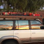
Electrical power for communications and refrigeration is provided by our two 100W solar panels and three 12V AGM lead acid batteries. And, we can run the engine for power. We also have small portable solar panels for the phones and the InReach.
We should have 105+ gallons of gasoline/petrol. Note: “Gas” is propane not gasoline in Australia.
Vehicle Breakdowns
I cannot think of a credible scenario when we would abandon our vehicles in a breakdown. Maybe if were a few miles from civilization and walking would be prudent? Maybe if we were running out of water and were close to a known water source? If we do abandon the vehicles, we will leave a note with our plan.
We will be hiking. Mostly day hiking for a few miles. I can’t imagine that we would go for any overnight hiking trips into the bush. If hiking in the bush, we are likely to bring a small survival kit – water, snacks, tarp, InReach, etc. Mostly, we’d be hiking in established areas if we’re doing any real distance. For instance, there are petroglyph sites that people visit.
Water Purification Methods
If needed, we have fire, iodine tablets, U/V light SteriPens, and a micro filter backpacking filter.
Medications/First Aid
First aid kit #1
✓mirror
✓coban x 2
✓paracord – orange
✓3” and 4” ace wraps
✓irrigation syringe
✓Potable Aqua – 1 bottle
✓First aid book
✓benzoin tincture x 5
✓quick clot x 2
✓SAM splint
✓Potassium Iodide Tablets x 14
✓space blanket
✓electrolyte replacement – pediatlyte x 4
✓bandages
✓finger splints x 2
✓antacids
First aid kit #2 Molle bag
✓alleve
✓wound cleaner
✓needle and thread
✓tums
✓triamcinolone cream
✓hydrocortosone cream
✓oral analgesic
✓bandaids
✓neosporin
✓anifungal cream
✓nail clippers will add in Aus
✓nail file will add in Aus
✓tweezers
✓bandana
✓gloves
✓scissors
✓benadryl x 24 tabs
✓allegra D x 15 tabs
✓antidiarrheal x 18 tabs
✓DayQuil x 16 tabs
✓cough drops
✓thermometers
We have different antibiotics for skin, stomach, UTI, issues, epi pens & pain medicine.
Navigation
GPS: iPhone, iPad, old Garmin eTrex handheld, APRS GPS within two ham radios
Mapping:
•MotionX app using OpenStreet Maps on iOS devices
•Gaia GPS app using OpenStreet Maps and satellite imagery on iPad
•DeLorme Earthmate app using their base maps
•Hema 4WD app on iPad and iPhone
•Outback Travellers Track Guide paper “strip map” for the Canning and Gunbarrel
•Various PDF maps on iPad and MacBook
Simpson Desert Plan
This could take 4-7 days to do. Overdue time = 10 days.
•Start in Birdsville (gasoline/provisions/communications)
•W on the QAA track to Poeppel’s Corner
•S on K1 to Rig Road -or- E on French Line and S on ??? to Rig Road
•W on Rig Road to end
•N on ??? to WAA Line -or- French Line to Dalhouse Springs (gasoline/provisions/comms)
UHF CB:
•Ch 10 – designed for checking oncoming traffic and is not to be used for general chit chat
•Ch 7 Duplex repeater – contacting Pink Roadhouse
•Ch 6 (2 or 4) Duplex repeater – contacting Mt Dare Hotel
•Ch 8 and 38 – reserved for emergency calls only
◦these channels are monitored by the Clinics, Police and station operators
◦Diamantina Shire (comprising the towns of Birdsville, Betoota and Bedourie
Emergency numbers:
•Birdsville Pub (07) 4656 3244
•Birdsville Roadhouse (07) 4656 3226
◦info@birdsvilleroadhouse.com.au
◦Bronwynne & Peter Barnes
◦will do vehicle recoveries!
•Pink Road House, Oodnadatta (08) 8670 7822
•Mt Dare (08) 8670 7835
◦has a mechanic and spares (shocks) and fluids
◦will do vehicle recoveries!
Alice Springs Area
Spend a few days around here doing hikes and eating kangaroo, crocodile, and emu.
Tanami Track/Road
This should take 2-3 days. Overdue time = 7 days.
•Head NW out of Alice Springs to
•Halls Creek if we need serious provisions -or Billiluna if we just need gasoline
The Canning Stock Route – First Half
This should take 10-11 days to do. Overdue time = 15 days.
•Begin in Billiluna (gasoline)
•SW to Kunawarritji (gasoline/food/communications)
The Canning Stock Route – Second Half
This should take 10-11 days to do. Overdue time = 15 days.
•Begin in Kunawarritji
•SW to Wiluna (gasoline/provisions/communications)
Alternate Trailer Route in Canning
UHF channel
Contact numbers
Emergency Contacts:
Names and information deleted for privacy…
____________________________________________________________________________
If you have read through the entire emergency plan, you can see that Ryan is very thorough. [Luckily for our family and friends, they had this information. We found out later that they started to get antsy when they were unable to contact us and it appeared that we had stopped moving at Lake Disappointment.]
Today we explored Lake Disappointment and decided to take a bush shower on a small peninsula on the lake. The view was spectacular!
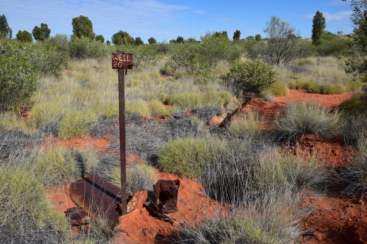
We took a 20 km detour to Well 20.
We had our first creek crossing at Savory Creek. LeeWhay walked the creek to check for depth.

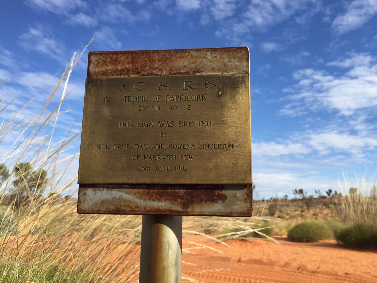
We crossed the Tropic of Capricorn today.
We camped at Well 18 for the night. There we met a single man traveling with his dog in a 70’s series LandCruiser Ute. We sat around a campfire and chatted into the night.
-Ryan & LeeWhay